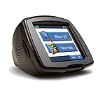
So I broke down last night and purchased the latest map update for my Garmin StreetPilot c340. After downloading the 2gb file and running into a few setup issues, I finally got it installed on the GPS.
This morning, I fired the unit up on my way to work, as I am wont to do (mainly to see my estimated arrival time). Imagine my surprise when, as I was driving on I-275 North over the Howard Frankland Bridge (which goes over the bay), the GPS display looked like I was driving over land instead of water:

Yes, this is a minor thing since it’s just a display issue (the routing and navigation is working fine), but it’s really annoying since this was an “update” (that cost me $60) which clearly has some sort of corruption in it. If I zoom out far enough, eventually the correct map is displayed:
 But I shouldn’t have to deal with that. And who knows what else is messed up?
I tried re-installing the map update from scratch, resetting the GPS, changing map views (3D vs. overhead) and detail levels, etc. without any luck. I’ve opened a support ticket with Garmin and am waiting to see what they have to say.